Once you’ve decided Helium mining might be right for you, you will be keen to understand the potential coverage your setup may have and also what potential benefits you may gain from a new antenna, or higher placement. Understanding this can help you see which other hotspots you’re likely going to be able to connect to and witness off of, which in turn contributes to your earning potential.
Fortunately, we have a few tools that can help us run simulations drawing on topographical and other information about the surrounding environment. Today, we’re gonna briefly look at HotspotRF.
HotspotRF
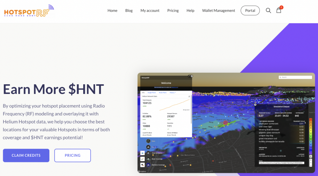
HotspotRF enables its users to run advanced simulations of how the radio waves promulgate through your surroundings, outputting a visual heatmap of the footprint of your hotspot.
Where HotspotRF really shines is for those intending to large volumes of hotspots with hosts. With a fleet of hotspots and potential host locations, and plans to deploy them over a city, a service like this is invaluable in evaluating placements against each other, and in determining how to deploy your miners most effectively, to maximise both coverage, and Helium/HNT token earnings potential.
Pricing
I encourage you to open up hotspot RF and test things out.
With a free trial account, you’re given 10 free credits, which will enable you to run 10 simulations – more than enough for the deployment of a single hotspot, say at home.
If you need to run more simulations, pricing starts at just USD$10 per month for a Hobbyist account which gives you 10 additional credits per month, and also enables the calculation of estimated rewards. While everyone loves and preserves free services, you’ll quickly see the value of a service like this and how fast you can save/make money by making better, and more informed data-driven decisions.
How-to
While running a simulation of radio waves in a suburb sounds (and is) extremely complicated, HotspotRF makes it super easy requiring only a handful of basic parameters to be set. Sign up for a free account and go give it a try.
Here’s what you’re going to need to enter in order to run a simulation:
- Radio frequency – for us in Australia, set this to AU915
- Antenna gain (dBi) – enter the gain for the antenna you intend to deploy in dBi.
- Cable Loss (dB) – This is where you can account for the loss in signal strength for long runs of coaxial cable. This loss is relatively small typically. Leave it as 0 or maybe 0.3-0.5 or so for a normal 3-5m run.
- Height – Set the height in metres (or feet) – this is the height the antenna will be above ground level. Most houses in Canberra have 8 foot ceilings (~ 2.4m approx)
- Hotspot Placement – This will be where the antenna is located, rather than the hotspot itself. Options here are:
- Outdoors
- Indoors, or
- Unsure
- Finally, Terrain – Pick from:
- Urban – Tall buildings everywhere
- Healthy Mix – 3-4 storey buildings scattered (occasional tree)
- Suburbs – 1/2 storey houses everywhere (occasional tree)
- Wooded Area – Trees w/ the occasional barn
- Clear line of sight -Can see for miles on end
And that’s it.
Double check what you’ve entered and click Simulate Location to use one of your free credits.
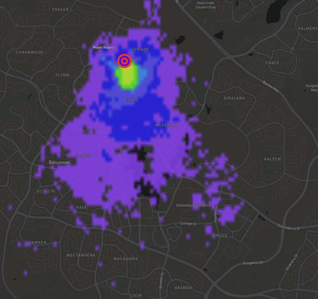
After 10 or so seconds, the simulation is complete and the map will display a heatmap showing the signal strength from this simulation giving you a clear visualisation of the likely effectiveness of your setup:
Another benefit is the ability to then save the simulation as a KMZ file and import it into other mapping tools like Google Earth to share with others. Click Download KMZ to backup a set of the simulation data on your computer, and for use with other tools.
Here’s a quick simulation I ran from Spence, where I intend to install a roof-mounted antenna on top of a two storey home. I set elevation to 8m above ground level (two floors of roughly 2.5m, roof height plus 1.5m), it will have a 5.8dbi antenna, and the terrain I set to Suburbs:
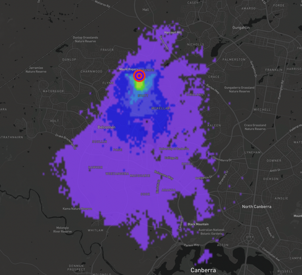
Straight away I see I have good coverage of most of Belconnen, AND I see the impacts the hill to my west has on things. I’m pretty happy with what I see here, and already know I should be able to reach maybe 4-5 hotspots that are planned to be deployed in the area by cross referencing against the shared map of planned hotspots.
After this, I ran several other simulations to compare performance, which helped me decide on some antennas to buy, having been able to see the difference they should make.
I’m glad to have found HotspotRF and will use it for other hotspots I plan to deploy (when they finally arrive!). Have you tried this service out – what’s been your experience? Care to share your simulations?
Will we be Helium network-neighbours? 😉


