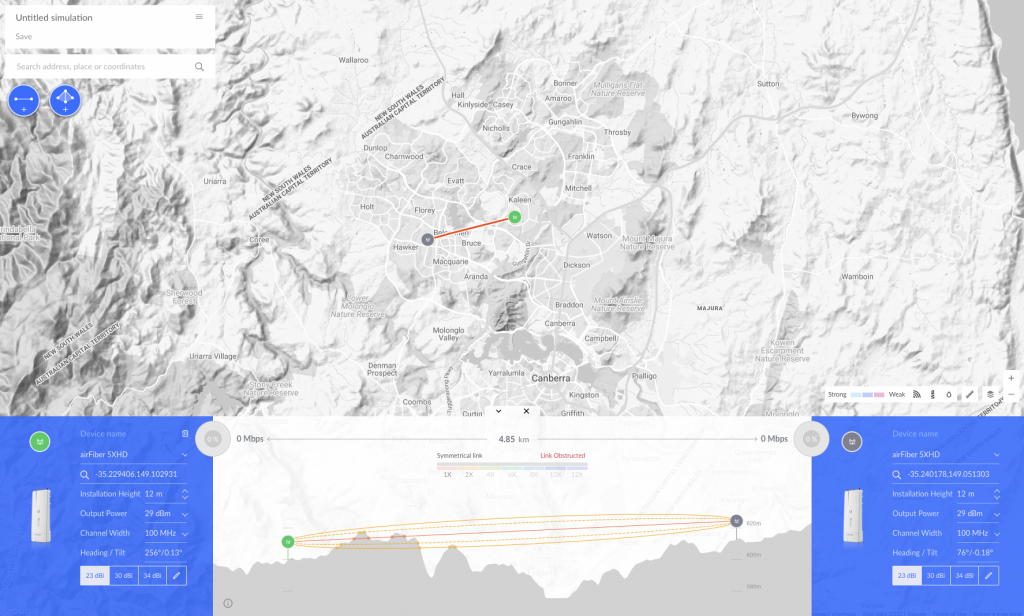
Here’s a quick tool – https://link.ui.com/# – (mentioned by @l34rn3d on the Helium AU915 Discord – thanks!) that’ll help with organising planning of Helium hotspot deployments. It’s intended as a planning tool for calculating point to point range and coverage of OTHER wireless technologies (by Ubiquiti) rather than for Helium hotspots. BUT the nifty thing is its ability to quickly calculate distance and Line of Sight (LoS) between two points across the land and to get an impression of whether you have LoS between two potential hotspot locations.

Note that this tool just takes into consideration the topography of the land and not necessarily what’s on the land – buildings, trees etc. Other tools like HotspotRF and Helium.Vision are likely better for that sort of thing, as well as the 360 degree mapping they offer.
To use
To use, simple search for a location or navigate through the map by clicking and dragging
- Drop a pin anywhere you like
- Click ‘Add PtP’ to add a second Point-to-Point marker
- Drop another pin for that marker
You’ll notice the two blue panels at the bottom of the screen. These indicate the devices and installation locations of each marker. While most of the info here is NOT relevant to Helium deployments, I would pay attention to the Installation Height and adjust that accordingly.

The simulation happens almost instantly, so take a look at the panel below and review distance and the profile of the land between the two points. Drag and drop the markers to test the likelihood of line of sight.
There’s a also a PtMP option (Point to Multi-Point) which allows you to generate multiple LoS from a single node to other hotspot locations you hope to hit.
The tool is free to use, which makes it even better. It seems you do have to create a Ubiquiti account though for subsequent use. I already had one as I own some Ubiquiti gear. I believe they are also free to set up.
Try it out and see how you go.


